The Ramblers
Members of the Ramblers enjoy:
- A library jam-packed with thousands of tried-and-test routes. Online and Exclusive to you on the app
- Unlimited free access to 50,000 Ramblers group walks, guided by a walk leader along safe, accessible routes
- Savings on walking gear, gadets and more with exlusive discounts from Cotswold Outdoor and our partners
- A welcome pack teeming with top tips plus our quarterly Walk magazine
- What's more, you'll be a driving force behind increasing access to green spaces, opening up more places to walk and boosting Britain's well-being one step at a time, just by joining the Ramblers
Members Notice
Merthyr Ramblers Social Evening
Join us every first Monday of each month at 6pm in Merthyr Wetherspoons (Y Dic Penderyn) for our monthly social evening. Everyone welcome - come and meet the Merthyr Valley Ramblers. Good company and a quiz to boot. Downstairs in the old library.
Please tag your photographs in Instagram with the Merthyr Valley Ramblers hashtag: #merthyrvalleyramblers
Click here to view Our walks Journey so far through 2026
Click here to view booking walks for Merthyr Valley ramblers
Walks coming soon …
click on walk date to view walk information
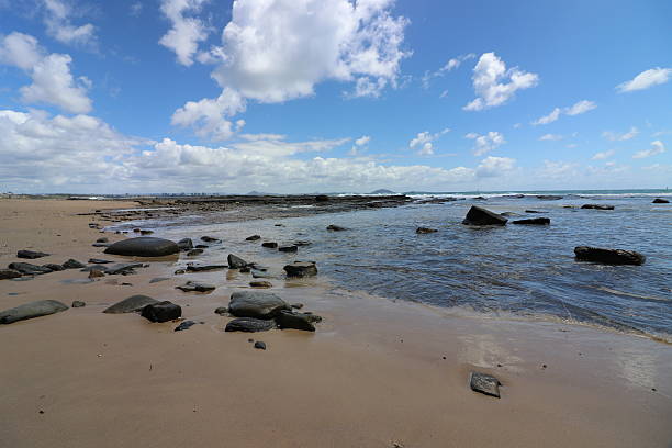
Southerndown
Date: Saturday, 1 Aug 2026
Walk type: Circular
Start time: 10:00 am
Estimated finish time: 3.30 pm
Distance: 8.5 miles / 13.7 km
Ascent: 813 ft / 248 m
Walk difficulty: Moderate
Booking is necassary
Walk description: We initially go away from the coast through the fields to the village of St. Brides and then along the lanes to Castle-upon-Alun. We then loop back through the village of St. Brides and go through the dunes to the Ogmore River. Our route then follows the river to Ogmore-by -Sea and back along the coast path to Southerndown . In the event of very hot weather, it is possible to curtail the walk to 7 miles by cutting out the loop through Castle-upon-Alun and still enjoy the coastal path section. (Car parking charges apply and so car sharing is encouraged). Note this is not the cliff top car park - follow the road down the hill to the beach.
Start Place: Lower car park at Southerndown Beach (Charged)
Grid Ref: SS 88544 73149
What3Words: bakers.triathlon.froze
Walk classification:
Suitability: Moderate.
Surroundings: Coast, dunes, farmland, river, village
Facilities: Parking, (Charged) Toilets. Refreshments
To be announced …
Date: Saturday, 8 Aug 2026
Walk leader: John Holloway
Walk Title: Aberdare Lakes and Rivers
Distance: 8 miles
Grade: Moderate
Date: Saturday, 15 Aug 2026
Walk leader: Martina Lewis
Walk Title: Brecon Beacons Horseshoe Ridge walk
Distance: 10 miles
Grade: Strenuous
Date: Saturday, 22 Aug 2026
Walk leader: Peter Cawley
Walk Title: Llandegfedd reservoir, Cwmbran
Distance: 6.5 miles
Grade: Moderate
Date: Saturday, 29 Aug 2026
Walk leader: Morfydd Jenkins
Walk Title: TBA
Distance: TBA
Grade: TBA